Welcome To AgriLytics!
Application For Crop
AI Based Crop Acreage Detection.
Deep Learning Techniques
AgriLytics uses modern deep learning techniques to predict crop statistics and providing crop yield analytics
Learn moreHighly Accurate LULC Maps
AgriLytics ensures delivery of Land Cover and Use Maps (LULC) with more than 97% accuracy.
Learn moreModern and Responsive Design
The AgriLytics application is designed using modern Material UI elements and responsive webpages.
Learn moreAbout AgriLytics
AgriLytics is a web-based crop statistics generation system, and primarily designed for quick results generation and visualization.
6
Crops Covered
12
Districts Covered
90,000+
Hectares Covered
10+
AI Models
Features
Satellite Data Retrival
Easy access to Sentinel-2 and PlanetScope satellite data for seamless analysis.
Preprocessing
Preprocessing of satellite data to prepare it for feeding into the AI Model.
Deep learning models
Deep learning models are trained based on the preprocessed satellite data.
Crop classification
After training, crops are classified by region or union council (UC).
Crop Yield Estimation
Estimation of crop yields based on the previous data.
Results Generation
Results can be generated either by region or UC and can be stored on local server.
Case Studies
Charbagh
Agrilytics' study in Charbagh used high-resolution satellite imagery to classify land into agricultural, urban, forest, water bodies, barren, and grassland. Key findings include significant agricultural land with notable tobacco cultivation, urban expansion, and varied forest cover, providing crucial insights for sustainable planning and development.
Learn more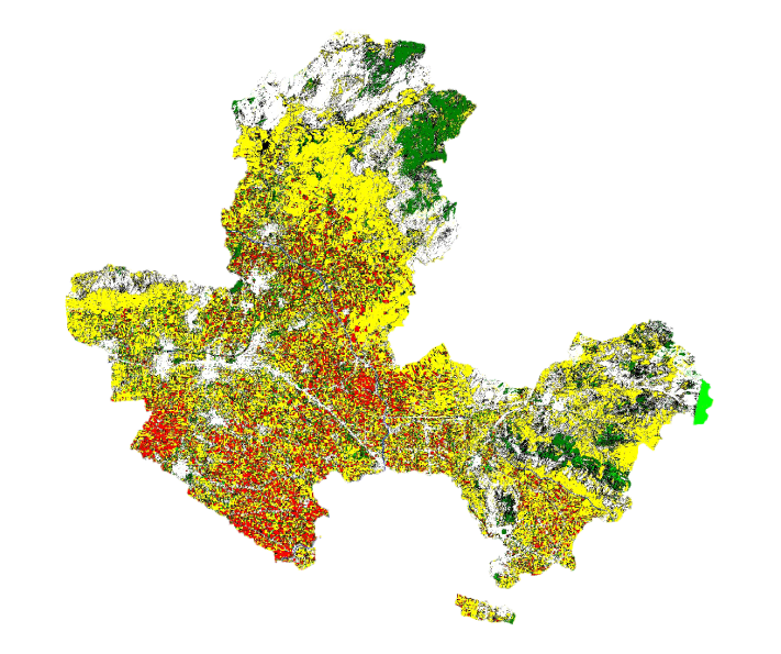
Chota Lahore
Agrilytics' study in Chota Lahore used high-resolution satellite imagery to classify land into agricultural, urban, forest, water bodies, barren, and grassland. Key findings include significant agricultural land with notable tobacco cultivation, urban expansion, and varied forest cover, providing crucial insights for sustainable planning and development.
Learn more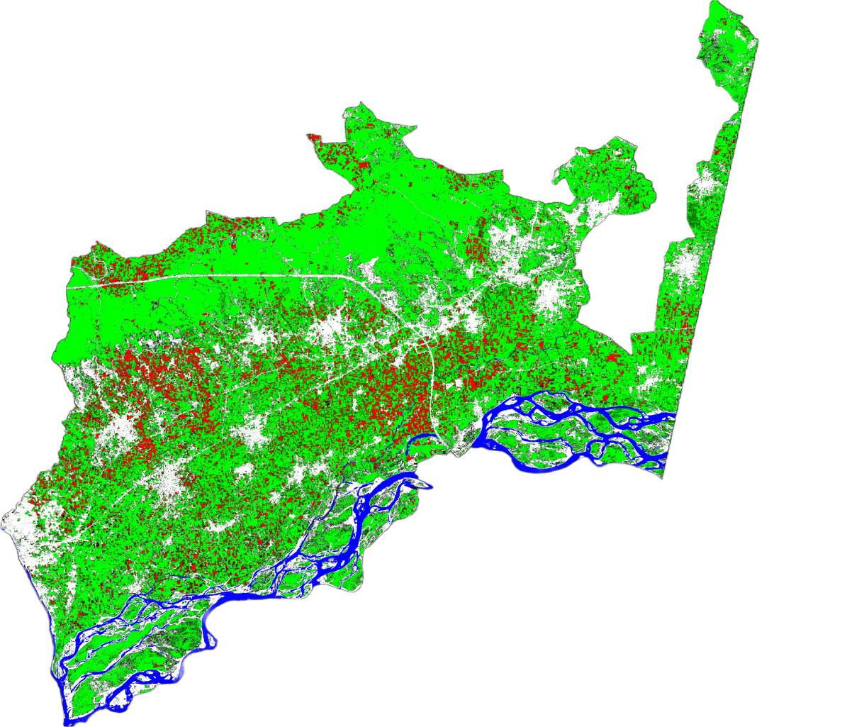
Takhtbai
Agrilytics' study in Takhtbai used high-resolution satellite imagery to classify land into agricultural, urban, forest, water bodies, barren, and grassland. Key findings include significant agricultural land with notable tobacco cultivation, urban expansion, and varied forest cover, providing crucial insights for sustainable planning and development.
Learn more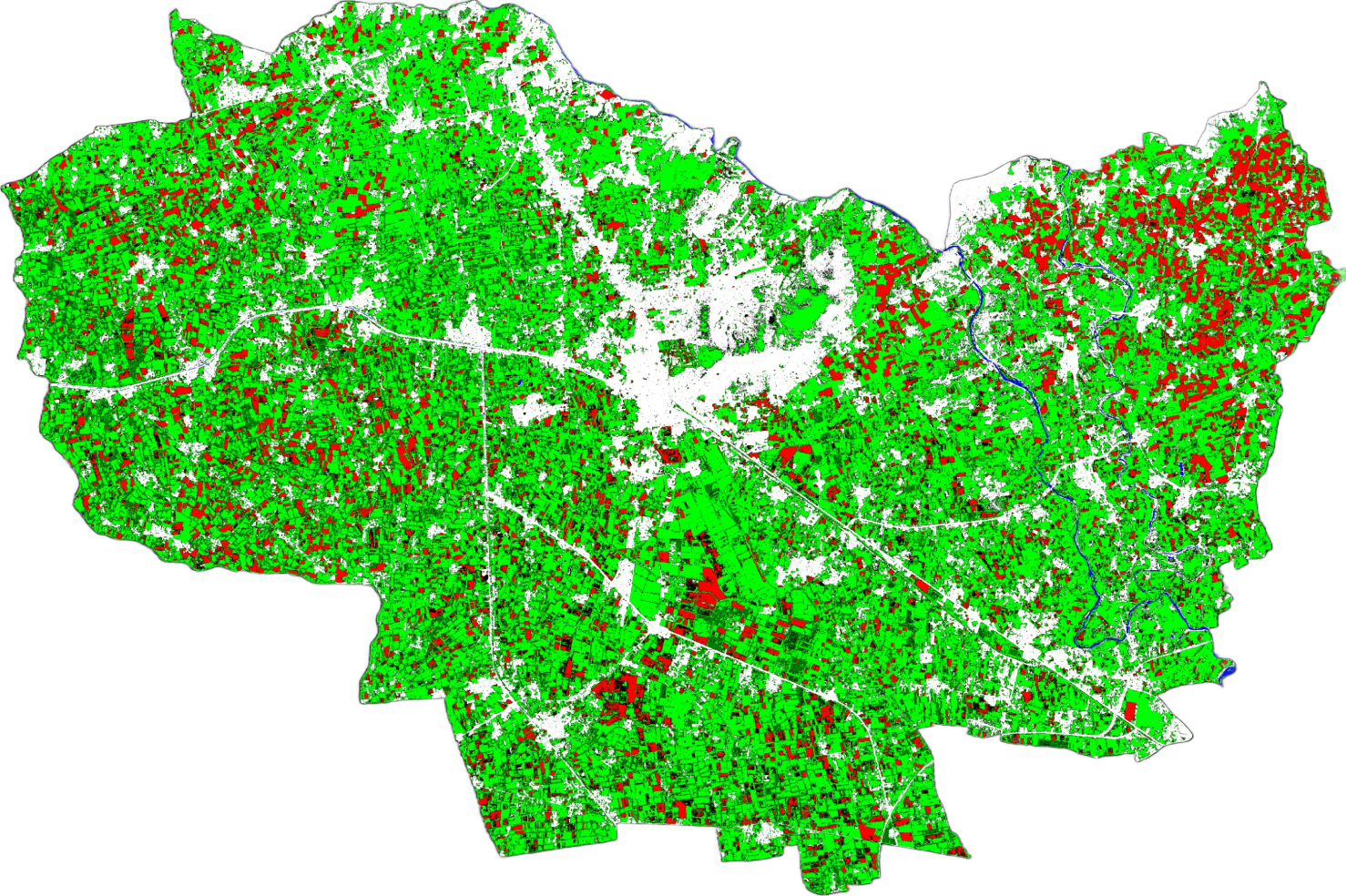
Yar Hussain
Agrilytics' study in Yar Hussain used high-resolution satellite imagery to classify land into agricultural, urban, forest, water bodies, barren, and grassland. Key findings include significant agricultural land with notable tobacco cultivation, urban expansion, and varied forest cover, providing crucial insights for sustainable planning and development.
Learn more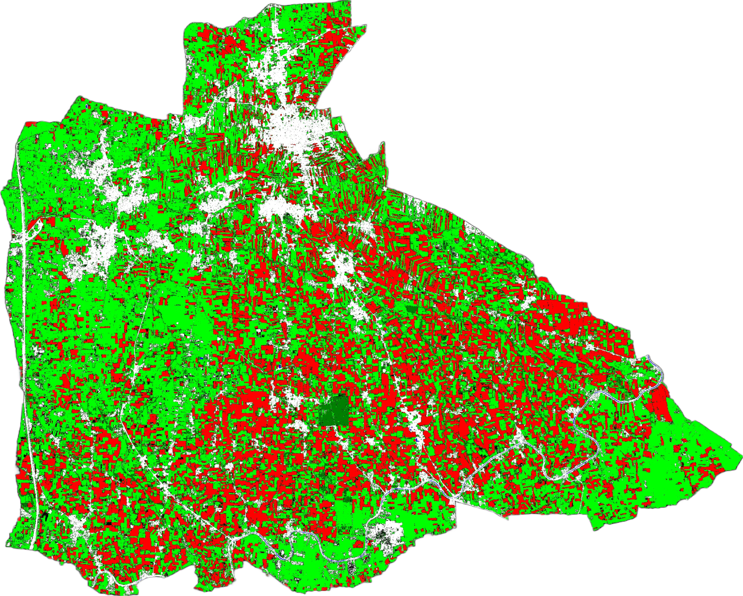
Our Clients

Get in touch
We'd like to hear from you
Don't hesitate to get in contact with us no matter your request. We are here to help you.